
Pacific Centered World Executive Map - Standard Paper
$12.74
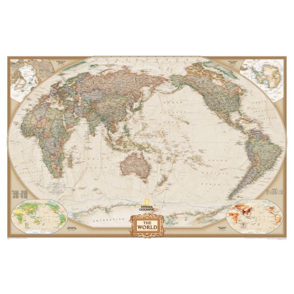
- Detailed, National Geographic Cartography.
- Earth-Toned Palette; Ocean-Floor Relief.
- Premium Quality Paper Stock.
- Standard Size: 30" x 46"; Scale: 1:36,384,000.
Availability:
In stock
SKU
NG-PCWorld-ESP
|
While most projections show the two distorted halves of the Pacific Ocean on the left and right edges of a world map, here we see the entire Pacific and all of the landmasses that border its rim in one piece and with less distortion. With this map, National Geographic employs attractive earth tones in the presentation of their renowned cartography, which includes accurate political boundaries, thousands of place names, special insets and much more. |
See Other Formats Available
|
|
About National Geographic Maps National Geographic is a world leader in the production of state-of-the art political, physical and thematic maps. Through the combination of space-age technology and innovative digital mapping techniques they have acquired a vast database of geographic information. The Society's mission to create maps that "inspire people to care about and explore the world" is facilitated by their meticulous research and steadfast attention to detail. Their determined efforts have enabled them to achieve the highest level of cartographic excellence. |
|
Write Your Own Review