
Physical World Enlarged Map - Paper
$29.42
- Exquisite Hand-Painted Relief.
- Premium Quality Paper Stock.
- Enlarged Size: 48" X 69"; Scale: 1:24,031,000.
Availability:
In stock
SKU
NG-World-PEP
|
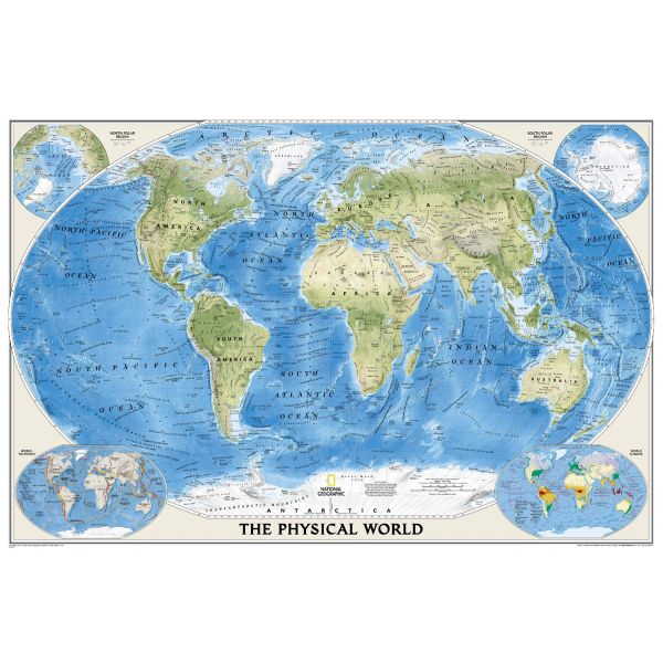
National Geographic's Physical World-Ocean Floor Map reveals the earth's physical features both above and below the surface of the sea. The fractured ocean floor and terrestrial landforms are artfully rendered in shaded relief. Two corner insets show the earth's crust and world climatic zones and as with all of their world maps, National Geographic has employed the Winkel Tripel map projection to minimize landmass distortion in the higher latitudes. |
See Other Formats Available
|
|
About National Geographic Maps National Geographic is a world leader in the production of state-of-the art political, physical and thematic maps. Through the combination of space-age technology and innovative digital mapping techniques they have acquired a vast database of geographic information. The Society's mission to create maps that "inspire people to care about and explore the world" is facilitated by their meticulous research and steadfast attention to detail. Their determined efforts have enabled them to achieve the highest level of cartographic excellence. |
|
Write Your Own Review